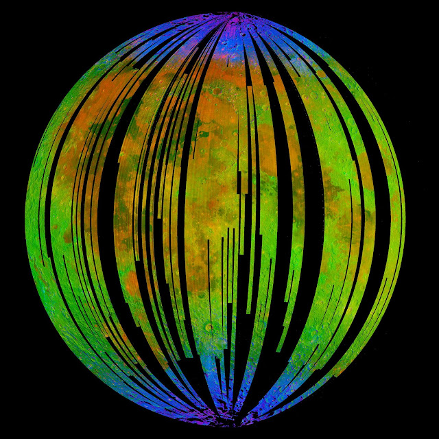
This image of the Moon is from NASA's Moon Mineralogy Mapper on the Indian Space Research Organization's Chandrayaan-1 mission. It is a three-color composite of reflected near-infrared radiation from the Sun, and illustrates the extent to which different materials are mapped across the side of the Moon that faces Earth.
Small amounts of water and hydroxyl (blue) were detected on the surface of the Moon at various locations. This image illustrates their distribution at high latitudes toward the poles.
Blue shows the signature of water and hydroxyl molecules as seen by a highly diagnostic absorption of infrared light with a wavelength of three micrometers. Green shows the brightness of the surface as measured by reflected infrared radiation from the Sun with a wavelength of 2.4 micrometers, and red shows an iron-bearing mineral called pyroxene, detected by absorption of 2.0-micrometer infrared light.
Photo credit: ISRO/NASA/JPL-Caltech/Brown University/USGS
Update: For more information, see NASA-Funded Scientists Detect Water on Moon's Surface that Hints at Water Below.

